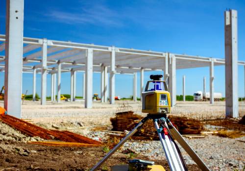
Drones are one of the best data-gathering tools for construction. Drones provide that great vantage point view of your project, as you are able to look down upon the jobsite and get a full view of the project area. And from that position, they can collect a lot more data with greater efficiency and safety than terrestrial surveying equipment.
“A good surveyor with a base station will pick up under a thousand points of data per day,” says Cole Moon, Technical Sales Manager, senseFly, an AgEagle Company—manufacturer of fixed-wing drones designed for real, construction-survey, GIS-integrated workflows. “With a 45-minute drone flight, you will get millions of data points.”
Create better bids
Use a drone to gather topographical data when putting together an estimate and save time and money. A surveyor may take a few days to map a large site with a base station—which can cost thousands of dollars per day in labor—versus surveying the same area with a drone in just under an hour. Also, hills, valleys, trees, and other obstacles introduce potential safety risks and add hours of work. With drones, the terrain doesn’t add to the length of time it takes to safely survey the area and you can complete a week’s worth of work in one afternoon.
“Typically, the most expensive part [of a construction project] is earthworks. Contractors don’t want to move dirt more than once,” says Moon. “Drones provide a good overview of the site, so they can determine how much material is on-site, how much material is lacking and needs to be brought in, how much equipment is needed, and for how many days. The drone’s data can then be entered into a civil application for master hauling in a short period.”
Now, the amount of time it takes to upload the information from a drone (regardless of manufacturer) depends on the processing power of the computer.
“The time it takes for image processing is related to the size of the job site being mapped and altitude flown and can range anywhere from a few minutes to a few hours,” says Moon. “Also, consider whether your computer has the power to process your images quickly or if you should consider using a cloud-based solution.”
Cut cost overruns
After you’ve been awarded the contract, use your drone to monitor construction progress and track on-site assets and materials.
“Some companies launch their drone every morning and then that data becomes available to all key personnel for the remainder of the day,” says Moon. “For project managers, this cuts down travel time, especially in high-traffic areas, since they can now view the site remotely.”
On sites with a lot of equipment, fleet inventory tracking can be challenging, especially when companies move equipment between job sites and some are likely rented.
“I know companies who use a drone combined with an artificial intelligence program for tracking on-site assets,” said Moon. “With this data, companies can verify how long rented equipment was on-site for example, so they can verify the amount of time they’ve been billed.”
Aerial imagery can also be used in the verification of deliveries. By regularly monitoring a construction site, companies can begin to do deep-dive verification on cost overruns.
Equipment inspection
The final reason contractors should use drones during the construction phase is for inspection of as-built items. Drones are an efficient way of inspecting which allows construction managers and engineers to determine whether a project was built according to plan.
For example, many firms are using photogrammetry during construction to create a digital twin, (an exact digital replica of a project or asset), to ensure quality and that the work stays true to the design.
A new user’s biggest mistake
According to Moon, the biggest mistake new users make is believing that flying a drone is too complex and difficult.
“You need to plan your flights,” says Moon. “If you can, travel the area where the drone will be flown. Flight planning software doesn’t reveal some information, such as the location of power lines and radio towers, or wind conditions. You must know how your drone will function in those environments.”
According to Moon, the senseFly eBee X comes equipped with eMotion flight-planning software, which delivers an intuitive and seamless experience that contractors will appreciate. Within, you can simply draw a line around your project site on a map, launch and the drone completes its autonomous flight, returning without any human intervention.
From measuring material volumes to conducting pre-and as-built surveys to monitor site progress, it’s easy to see how construction drones are elevating accuracies, efficiencies, and safety around the job site.