A drone lifts off before sunrise and by mid-morning the jobsite has been mapped, measured and photographed from every angle. On the ground, data is downloaded and processed. Then what? This is where many contractors get stuck.
Contractors are no longer asking whether drones belong on the jobsite. The bigger question is how to use the information collected to improve decisions once the flight is over.
If the data can’t be used, it won’t impact decisions.
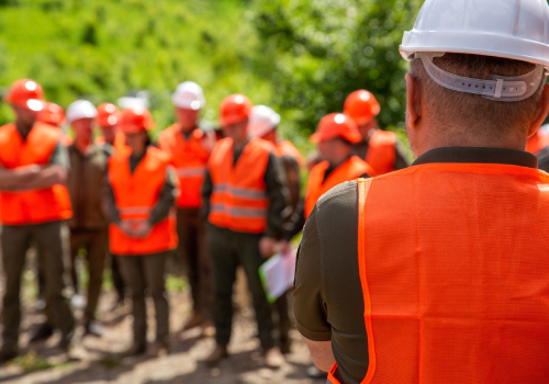
WHY SOME CONTRACTORS SEE VALUE, BUT OTHERS DON’T
Data collected by drones can help guide real decisions in the field if you know what to look for.
“You need to step back and think about how it’s going to fit into your business operations to help you make the decisions that you need to make from the data,” says Zach Pieper, director of operations and co-owner of Quantum Land Design.
Contractors who see consistent results know:
- Who captures and reviews flight data
- When flights happen during the project lifecycle
- Which decisions the information supports
Don’t forget to check software integration so outputs can be shared with all project owners for planning, tracking and estimating.
If the data can’t be used, it won’t impact decisions.
The most successful contractors don’t treat drone data as paperwork. They use it to drive decisions that affect cost, schedules and productivity.
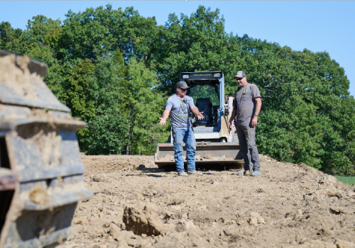
TURNING DRONE DATA INTO DAILY JOBSITE DECISIONS
Progress tracking is one of the clearest examples of how drone data can impact jobsite decisions. Weekly flights give teams a visual view of actual site conditions, making it easier to adjust crews or equipment before issues worsen.
On a dam excavation project, heavy rainfall damaged the site and required additional earth fill before concrete could be poured. Drone flights captured accurate site conditions and stockpile volumes after unsuitable material was moved to a designated area. That data allowed inspectors to ensure the contractor was paid correctly, avoiding a $250,000 loss.
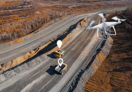
Volume calculations are another high-impact use. Photogrammetry—overlapping images processed into topographic maps—generates reliable, cost-effective data. Contractors should use it to catch delays early and reallocate resources.
On a project involving sludge volumes, contractors used drones to survey site conditions before work began. By capturing the surface and setting ground control points, workers were able to visualize how much liquid and solids were present without getting their boots dirty.
Aerial data helps teams identify grading, drainage and road constraints before work begins, preventing surprises. Drone data should show up in decision-making moments—schedule reviews, quantity checks and project meetings.
WHERE THE ROI ACTUALLY SHOWS UP
When drone data is used consistently, the return shows up in cost control and jobsite performance.
- Routine measurements that once required outside survey crews can be done internally, giving teams faster access to materials needed and existing site conditions.
- Weekly updates help teams spot grading issues, drainage problems and schedule conflicts before they cause delays and affect multiple crews
- Drone documentation creates a stronger project record. Accurate ground control points help teams compare drone outputs against survey and engineering plans when questions arise later in the project.
START SMALL AND BUILD A SYSTEM
The path forward starts with practical, targeted solutions that address an issue before it escalates.
“You need to figure out what problems you’re trying to solve with the drone,” says Zach, “how the drone can solve them, and then how you can work within the processes you have.”
From there, building a process is straightforward:
- Start with one use case and build a repeatable process around it. Assign ownership so someone is accountable for capturing and sharing the data.
- Measure the impact. Are schedule adjustments happening earlier? Are quantity checks faster or more accurate? Those signals determine whether the process is working.
- Address compliance early. Commercial drone use requires an FAA Part 107 certification, and teams need to understand those requirements before expanding usage.
Owning a drone doesn’t create value on its own. Contractors see results when they build a consistent process for turning drone data into faster decisions, better visibility and more informed jobsite operations.
“Drone data does not work alone,” Zach shares.
Zach Pieper shared these insights at the CONEXPO-CON/AGG 2026 session How to Use Drones in Your Earthmoving Business – Practical Applications. Watch the full session by purchasing On Demand Education Access from the CONEXPO-CON/AGG 2026 show.
PHOTO CREDIT: SHUTTERSTOCK/PARILOV