By John Dice, Director of Training for Topcon Positioning Systems
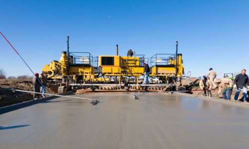
Machine control is a great tool for paving teams. The old days of simply eyeballing a job and hoping it’s close enough to specs are gone. Machine control enables the paving team to improve efficiency and productivity; control material quantities; improve smoothness and rideability; improve job site safety.
In order to work with machine control technology, the successful paving team leader must first do a few basic things.
First, the team leader must know the machine and understand the basics of paving and profiling. Equally important, they must spend the time and money to get their crew properly trained.
Second, when the crew is ready to begin paving, they can start paving in automatic control right off the blocks. Or, they can start paving manually as they normally do, and then switch to automatic control once they have the screed at the desired thickness.
Third, the team leader should assign a person to make sure the total stations or laser zone transmitters are set up properly. This equipment will control the paver or profiler to automatically follow the job design that has been downloaded from the software.
Is this job right for 3D machine control?
Before beginning the job, the crew director must make sure that the job makes 3D machine control necessary
- Is there a pre-defined job design?
- Is it tied to project control and elevation?
- Is there an incentive on elevation tolerance?
- Is there an incentive for meeting the design criteria?
What does it mean for a job to be 3D? Specifically, a pre-defined job design is put into a machine system’s 3D control box for the paver or profiler.
Two options for discussion of 3D machine control: 3D total station control and 3D Millimeter GPS control. Once you learn how they work, then you can decide which is the best for the job that you are working on.
 Total Station Control
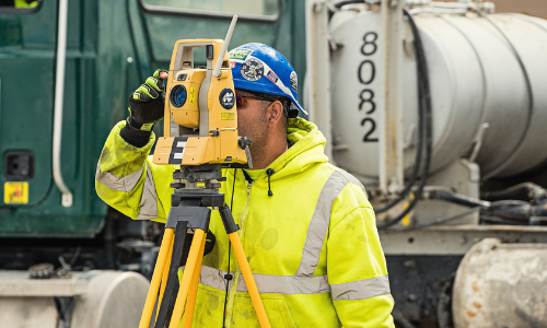
First, let’s talk about the total station control. Total stations (TS) track the horizontal and vertical position of the paver/profiler then sends the position information to the 3D Machine Control system.
The total station is positioned over a control point with a direct line of sight to the machine. That line of sight is important, so when setting up the TS, workers must consider machine and truck traffic so that the TS is not blocked from sending information to the paver.
One TS is needed for every device that is being controlled. For example, the plan might call for a TS for the left side of the paver, one for the right side of the paver and one for grade inspection.
It is important to remember that the team is using the 3D TS to control the paver or profiler according to the job design, not necessarily to the existing asphalt.
For a successful experience with total stations, the paving crew must regularly check to see that the depth of asphalt being laid is accurate. The paving team should use the survey rover for spot checks to ensure that the paver or profiler is at the right grade.
Generally, the team will need to have at least two total stations, one to run the machine, one set up to run the rover. Often a third is necessary as well; two total stations running both the left and right sides of the machine, and the third for the survey rover to check grade.
 Set up Multiple Total Stations or Leapfrog the Stations
For example, the paving team might have two total stations set up, one for the paver and one for the survey rover. Engineering specs state the paver can receive the signal from approximately 1,000 feet away. However, the team might want to keep the paver within 750 feet allowing for wind and vibration that might affect the total station.
Without a doubt you will be paving more than 1,000 feet, so you will have to set up multiple total stations. You don’t want to have to stop the paver frequently. You could potentially leapfrog by moving each TS ahead once the paver’s movement takes it out of range of each station.
3D Millimeter GPS Laser Zone Control
Another option for 3D machine control would be to employ laser control, utilizing a laser transmitter, such as Topcon 3D Millimeter GPS with Laser Zone control.
Instead of having the two reflectors as we would with the TS, this system uses sensors. The laser zone transmitter emits a plane of light that these sensors can use to measure the vertical position. The equipment is three dimensional, because it works with GPS, to locate the horizontal position on the job site.
Like when using the total station control, for example, the 3D Millimeter GPS Laser Zone control uses line of sight. So, it should not be set up where trucks and other machines would block it.
The Laser Zone control needs to establish a known elevation position. The 3D system will then produce a specific elevation that is referenced to benchmarks on the job site.
The transmitter is sending out a 30-foot tall band of light. The sensors can measure their vertical position relative to the transmitter readings. The transmitter is at a known height and can reference the control point.
An unlimited number of machine receivers can operate off one Laser Zone transmitter. As with the TS system, the paving team still needs to do inspections of the Laser Zone control to see that all the equipment is getting information from the same laser.
The paving team still needs to see that the grade is correct and that all pieces of equipment are using the same laser. As with the TS, the paving team should try to limit the distance for high accuracy paving applications and should consider wind and vibration as factors that could cause inaccurate information to be fed into the paver. Additional transmitters could be set up so the paver does not have to stop and wait.
Permanent Poles Can Deliver More Consistent Measurements
If the paving team is going to be onsite for a few days, they will want to set up permanent poles for the laser transmitters. This eliminates the need for multiple tripod uses, which could result in human error. Permanent poles will provide consistent height measurement.
In conclusion, no matter which 3D tool your team is using, the paving team should:
- Verify grade when starting a pass
- Verify before/after when switching transmitters or total stations.
- Occasionally check in on a benchmark to verify the transmitter or TS is correct.
Which 3D system is best for your project?
To stay abreast of the latest GPS positioning solutions and trends, subscribe to CONEXPO-CON/AGG 365.


